
Charting the Depths: How Unmanned Surface Vessels (USVs) are Revolutionizing Waterway Mapping
Charting the Depths: How Unmanned Surface Vessels (USVs) are Revolutionizing Waterway Mapping
For centuries, understanding the hidden topography of our rivers, lakes, and reservoirs has been a challenging, often hazardous, endeavor. Today, a quiet revolution is underway, led by Unmanned Surface Vessels (USVs). These compact, robotic boats are transforming hydrological surveys, making them safer, faster, and more detailed than ever before.
Gone are the days of relying solely on manned survey boats. Traditional methods often put crews at risk in treacherous currents, shallow waters, or remote locations. USVs eliminate this human risk entirely. Operators can control them from the safety of the shore or a command center, deploying these rugged platforms to navigate dangerous zones, dense vegetation, or contaminated waters with ease.
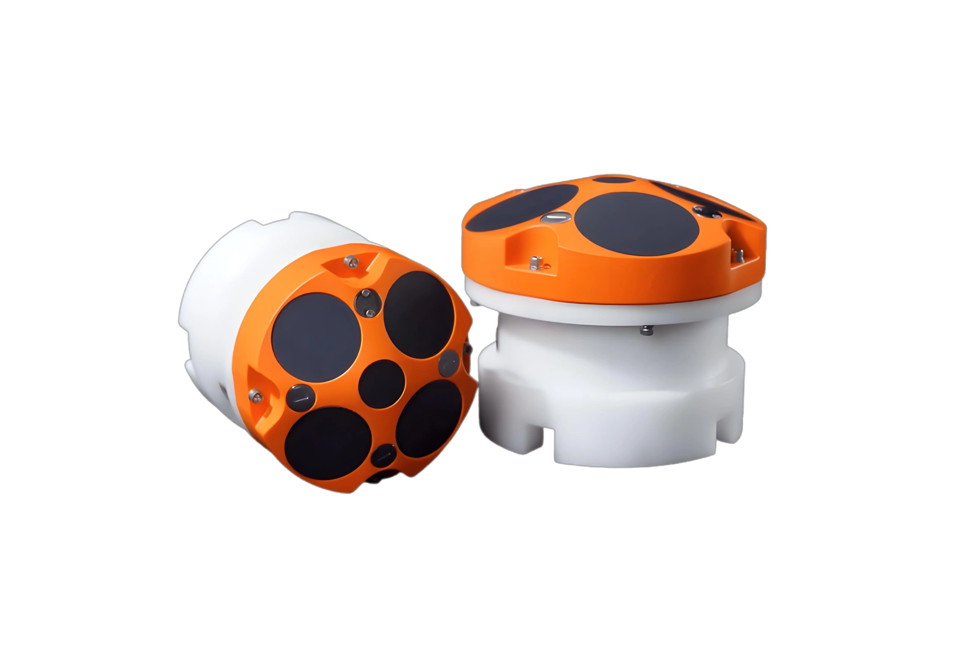
The real power of a USV lies in its payload. Equipped with multibeam sonars, side-scan sonar, and precision GNSS systems, these vessels paint a high-resolution, three-dimensional picture of the underwater world. They map riverbeds and reservoir floors with centimeter-level accuracy, revealing sediment buildup, erosion patterns, underwater infrastructure, and potential hazards.
So, what does this mean for our waterways?
For Reservoir Management: USVs provide precise capacity calculations and track sedimentation rates. This data is critical for optimizing water supply, predicting lifespan, and planning efficient dredging operations.
For River Restoration & Navigation: They map river morphology, identify scour around bridges, and monitor bank erosion. This informs flood modeling, habitat restoration projects, and ensures safe navigation channels.
Efficiency & Access: USVs can operate 24/7, covering vast areas in a single mission. Their small size allows them to survey areas too shallow or narrow for traditional boats, capturing data that was previously inaccessible or prohibitively expensive.
The benefits are clear: enhanced safety, unparalleled data density, reduced operational costs, and minimal environmental disturbance. As sensor technology and autonomy continue to advance, USVs will become the standard tool for hydrological insight.
We are moving beyond mere charts. We are building dynamic, living digital twins of our aquatic ecosystems. The future of understanding and managing our vital water resources is not just on the water—it’s unmanned.
上一篇:无