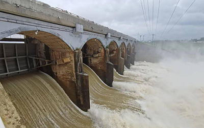
I. Project Background In recent years, people's living standards in China have improved significantly, and the demand for various resources has been gradually increasing. Among these, the demand for water resources is particularly prominent. Water resources not only play a key role in people's daily lives but also are an indispensable part of agricultural irrigation. However, China is facing a severe shortage of water resources, which requires people to save water in all aspects. Nevertheless, there is a serious waste of water resources in agricultural irrigation in China. Due to farmers' outdated awareness and insufficient irrigation facilities, water-saving irrigation has not been properly implemented.
In the process of agricultural development, water conservancy irrigation is the most critical part and has a vital impact on agricultural development. With the continuous development of society, China's population has been increasing, which has reduced the per capita share of resources. At the same time, due to the shortage of water resources, the total amount of water available for agricultural irrigation in China has been decreasing. Therefore, for China's agricultural water conservancy industry, it is particularly important to strengthen the development of water conservancy resources. We need to develop water conservancy irrigation equipment with superior performance, and improve the management of agricultural water conservancy by continuously increasing the utilization rate of water resources. In addition, China's agricultural development model is shifting from individual operation to large-scale intensive operation. Under this general context, strengthening the construction of agricultural water conservancy irrigation projects has become an inevitable trend. II. System Overview
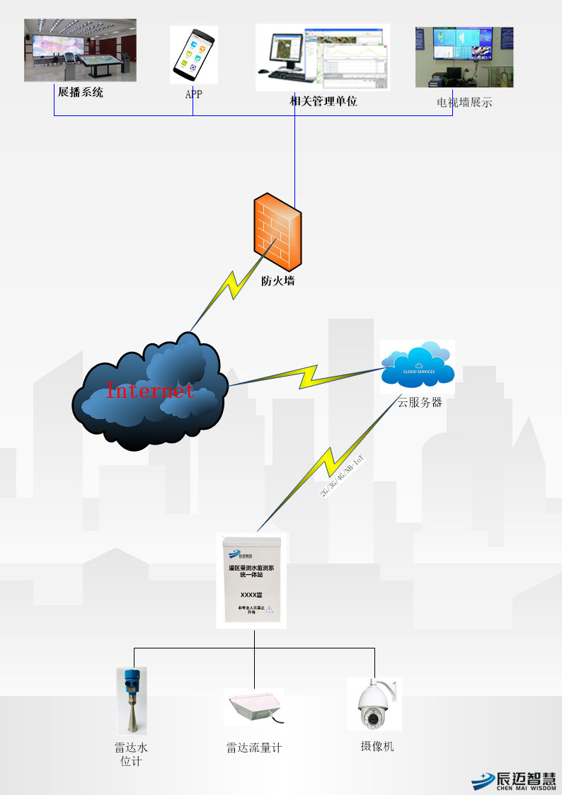
The irrigation area information system developed by our company is mainly composed of the perception and collection layer, network transmission layer, system application layer, and other components. Through the effective integration of wireless technology, perception layer technology, and new applications, it can be used for the transmission of various services. It fully meets the interconnection of things between monitoring stations in the irrigation area and combines the automation and informatization of agricultural production. The application layer, network layer, and collection layer work together to realize scientific, timely, and accurate allocation of irrigation water, so as to achieve the goals of water conservation, high yield, and high efficiency. This not only ensures the safety of the system but also provides basic and effective data for the management of water resources in the irrigation area, improving the enterprise's management level and production efficiency.
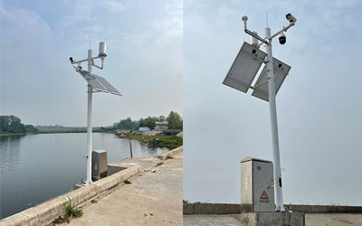
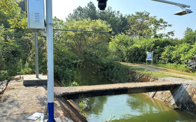
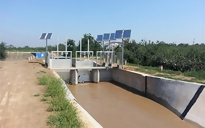
The telemetry terminal collects instantaneous flow and cumulative flow via a radar flow meter, stores the data, and transmits it to the platform through the Nb-IoT network or 2G/3G/4G networks. The platform parses the data and stores it in the database. This method is recommended due to its simple installation, convenient maintenance, and high measurement accuracy.
The telemetry terminal collects water level data, then calculates the corresponding instantaneous flow using the flow coefficient to calibrate the irrigation area flow. This method is suitable for specific installation environments.

IV. System Features
1.Open Structure
It has excellent scalability, facilitating continuous upgrading and improvement of the system in the future.
2. Time-Period Processing
The system can preset multiple time periods and convert real-time data into time-period data.
3. GIS Module
Supported by GIS technology, it establishes the topological relationship between data space and attribute features, enabling map query and management. It features a user-friendly interface, simple and flexible operation, and reasonable functional organization.
4. Scalability
The overall structure of the system adopts advanced design concepts, enhancing the system’s flexibility, upgradability, and balance. With a modular structure as the core, the software integrates split-screen technology based on database principles, meeting the needs of future development.
5. Stability and Reliability
It uses high-performance industrial-grade wireless modules and 32-bit communication processors; industrial-grade terminal interfaces with built-in reverse power protection and overcurrent/overvoltage protection; optional lightning protection for antenna interfaces; and a WDT (Watchdog Timer) design to ensure system stability.
6. Large-Capacity Data Storage Space
It provides 16MB of data storage space, which can store collected data for more than 10 years.
7. Low-Power Design
It supports multiple working modes (including self-reporting, query-based, and compatible modes) to minimize power consumption.
8. Industrial-Grade Design
It features wide-temperature design, with resistance to high and low temperatures and strong electromagnetic interference. Suitable for various harsh on-site environments, it adopts comprehensive system protection mechanisms and anti-dropping mechanisms to ensure the terminal is always online.
9. Flexible Hardware Configuration
Users can upgrade or replace controlled hardware devices at will without replacing the software.
10. Anti-Interference Capability
It has strong resistance to electromagnetic interference, ensuring reliable operation in harsh outdoor environments with strong electromagnetic interference.
11. Automatic Fault Detection
The system is equipped with an automatic fault detection function to improve system robustness.