
Solution for River Water Level and Flow Monitoring System
I. Overview
 II. System Composition
The river water level and flow monitoring system is mainly composed of the perception and collection layer, network transmission layer, and system application layer. Through the effective integration of wireless technology, perception layer technology, and new applications, it can be used for the transmission of various types of data, fully meeting the interconnection of things between river monitoring stations. The application layer, network layer, and collection layer work together to achieve scientific, timely, and accurate water level monitoring. It provides basic and effective data for relevant departments and improves the management level.
II. System Composition
The river water level and flow monitoring system is mainly composed of the perception and collection layer, network transmission layer, and system application layer. Through the effective integration of wireless technology, perception layer technology, and new applications, it can be used for the transmission of various types of data, fully meeting the interconnection of things between river monitoring stations. The application layer, network layer, and collection layer work together to achieve scientific, timely, and accurate water level monitoring. It provides basic and effective data for relevant departments and improves the management level.
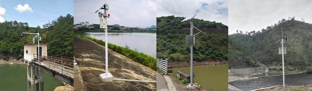
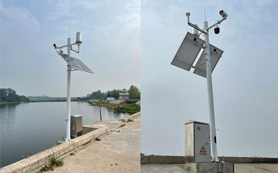
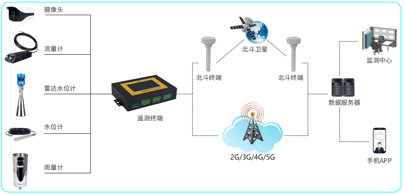 Perception and Collection Layer
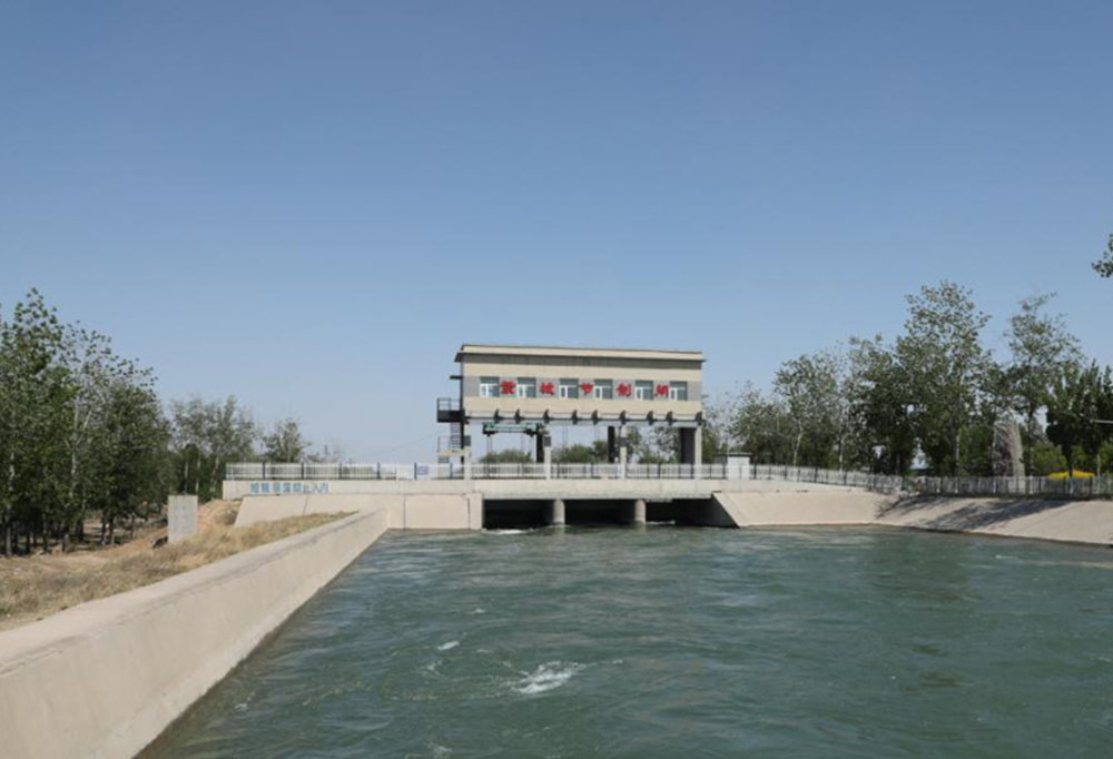
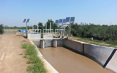
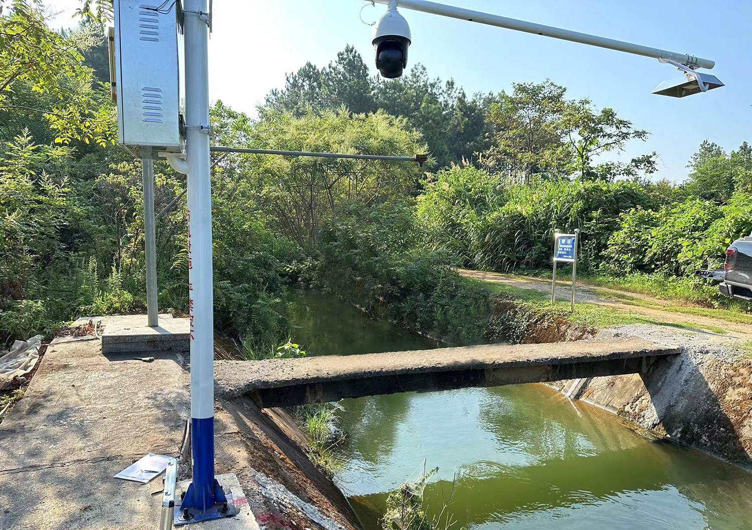
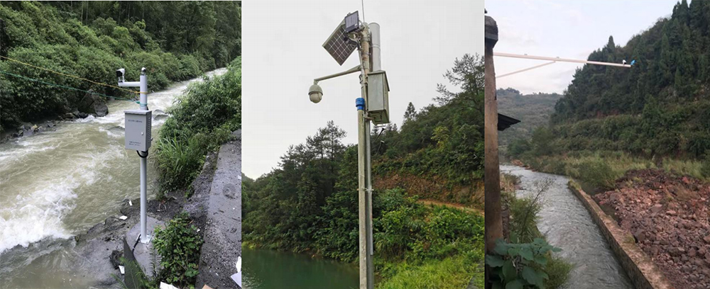
It collects all water level monitoring data of the river channel and uses all-round perception technology to conduct real-time collection of river channel information. The real-time collected information provides a basis for analysis and decision-making in river channel management.
◆ Transmission Layer
It mainly includes the local area networks (LANs) where users of systems at all levels are located, and the wide area networks (WANs) that interconnect the LANs at various levels. It covers the networks provided by operators and the wireless LoRa transmission used for data collection. It serves as a platform for transmitting various business information and a carrier for system data, providing a reliable and secure transmission channel for collecting various types of information.
◆ Application Layer
It is the core of the system to realize "platform intelligence, flat management, and service pre-positioning". By conducting comprehensive management and analysis of water resource monitoring data and providing standard service interfaces, this layer offers function and service sharing for the rapid construction of business application systems.
Perception and Collection Layer
It collects all water level monitoring data of the river channel and uses all-round perception technology to conduct real-time collection of river channel information. The real-time collected information provides a basis for analysis and decision-making in river channel management.
◆ Transmission Layer
It mainly includes the local area networks (LANs) where users of systems at all levels are located, and the wide area networks (WANs) that interconnect the LANs at various levels. It covers the networks provided by operators and the wireless LoRa transmission used for data collection. It serves as a platform for transmitting various business information and a carrier for system data, providing a reliable and secure transmission channel for collecting various types of information.
◆ Application Layer
It is the core of the system to realize "platform intelligence, flat management, and service pre-positioning". By conducting comprehensive management and analysis of water resource monitoring data and providing standard service interfaces, this layer offers function and service sharing for the rapid construction of business application systems.
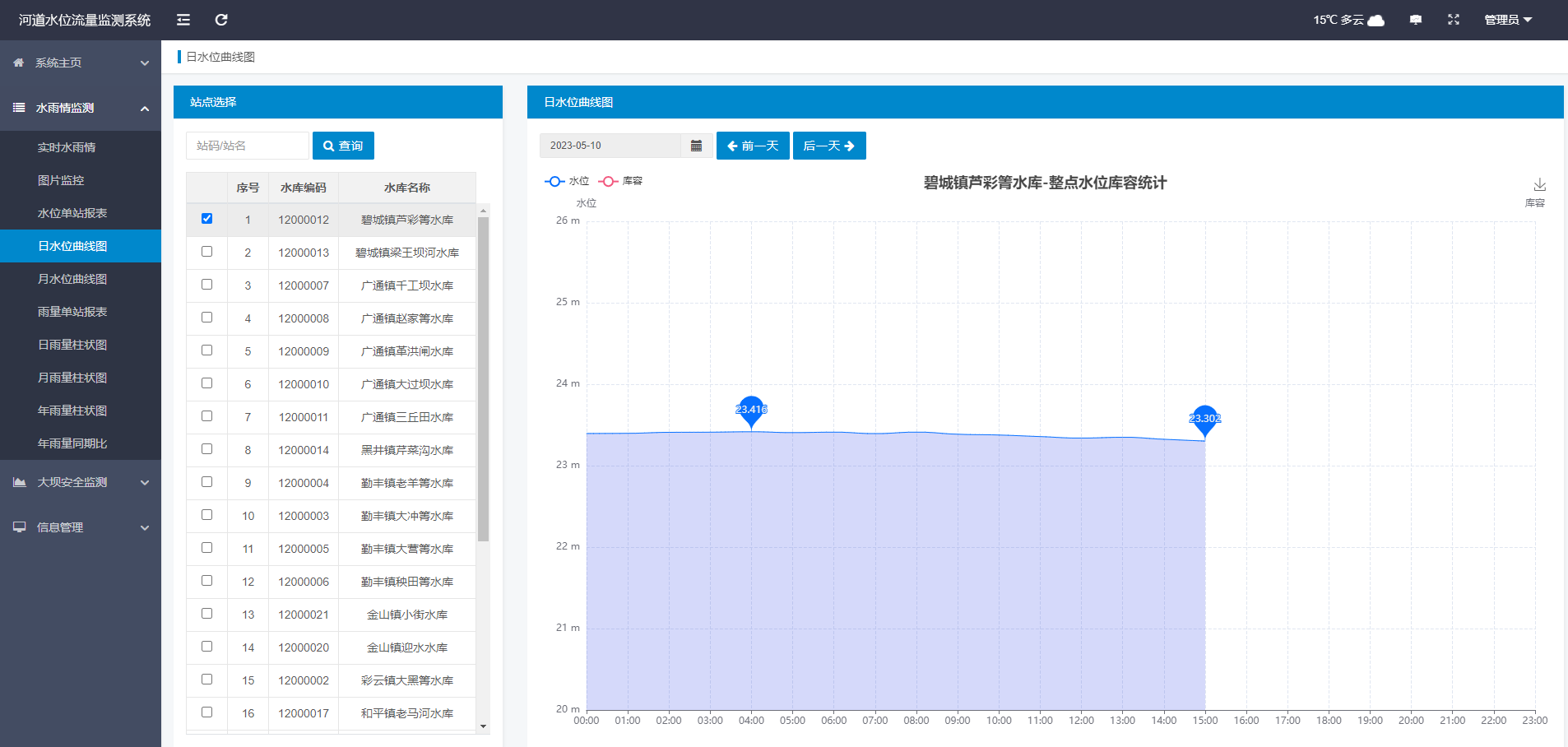
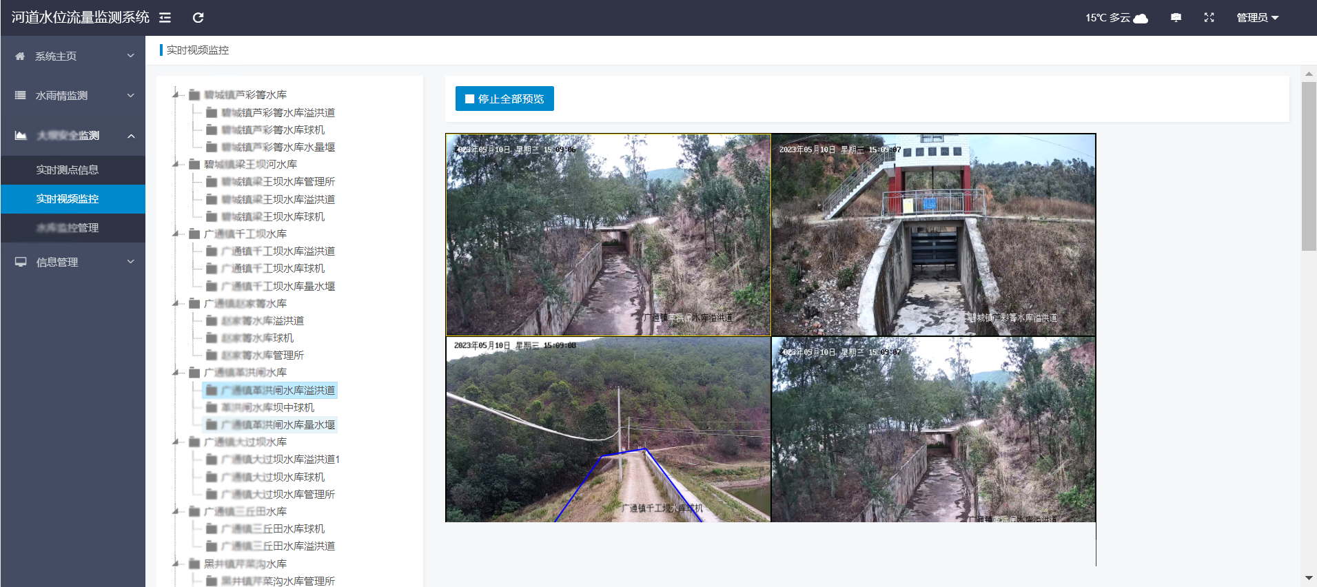
III. System Functions Real-Time Data Monitoring: It enables map display and viewing of online monitoring, including quick query and display of monitoring devices, presentation of monitoring data, display of alarm status, and real-time display of monitoring data curves. Through the display function on the system's main interface, users can check the location and operating status of devices, and keep track of how the devices monitor river channel status information via various sensors.
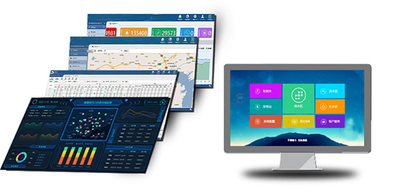
Remote Supervision Platform It enables data aggregation, display, and analysis, as well as statistics and analysis of various values. It supports functions such as setting early warning thresholds for automatic alarms and real-time data updates, with a data update rate of 5-minute intervals. This rate is user-adjustable; for example, when an excessive water level is detected, the system can automatically increase the frequency of data collection and transmission while sending alerts to administrators. It requires a permission setting function: there must be strict permission differentiation between data viewing and platform management, and the top administrator can customize permissions. ■ GIS Map Display It can provide Baidu or Google 2D/3D satellite images as the background, and support real-time monitoring of water level and environmental information at monitoring points and historical information query. This ensures the water level information is accurate and detailed. It also issues over-limit and over-standard early warnings to remind managers to handle issues promptly. Meanwhile, the platform supports multiple access methods such as mobile phones and PCs.
Unified Equipment Management
■ Remote Control Function
■ Data Communication
 IV. Solution Value
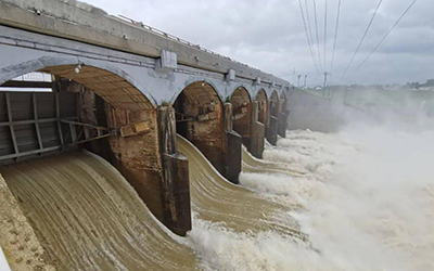
The river water level and flow monitoring system enables real-time monitoring of rivers and river water level data, and it is one of the important measures to ensure river flood control work. The real-time river information monitoring system realizes real-time monitoring of river water level based on wireless transmission technology and intelligent analysis technology. Through real-time monitoring of rivers, changes in rivers can be grasped in a timely manner, thereby enabling the analysis of river water level data and the timely adoption of measures to reduce the threats posed by flood disasters to people's lives and property safety as well as economic and social development.
At the same time, big data and meteorological data can be used to predict the water level of the river water level monitoring system, and relevant arrangements can be made in advance. It plays an important role in improving the water environment and promoting the effective use of water resources, serves as a key measure to alleviate water resource scarcity, and enhances the scientific and information-based level of environmental management.
IV. Solution Value
The river water level and flow monitoring system enables real-time monitoring of rivers and river water level data, and it is one of the important measures to ensure river flood control work. The real-time river information monitoring system realizes real-time monitoring of river water level based on wireless transmission technology and intelligent analysis technology. Through real-time monitoring of rivers, changes in rivers can be grasped in a timely manner, thereby enabling the analysis of river water level data and the timely adoption of measures to reduce the threats posed by flood disasters to people's lives and property safety as well as economic and social development.
At the same time, big data and meteorological data can be used to predict the water level of the river water level monitoring system, and relevant arrangements can be made in advance. It plays an important role in improving the water environment and promoting the effective use of water resources, serves as a key measure to alleviate water resource scarcity, and enhances the scientific and information-based level of environmental management.