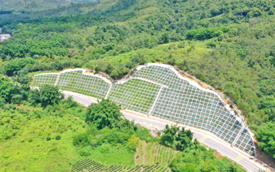
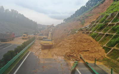
Human activities such as excessive deforestation, mine development, and road construction damage the ecology and affect the land structure. Without vegetation cover, the soil on hillsides becomes as loose as if it has lost its "glue," making it more prone to disintegration. In some parts of China, landslide accidents occur frequently, with over 140 large-scale landslides and more than 2,212 medium-sized landslides developed.
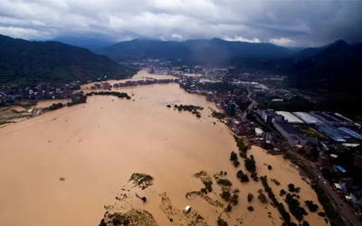
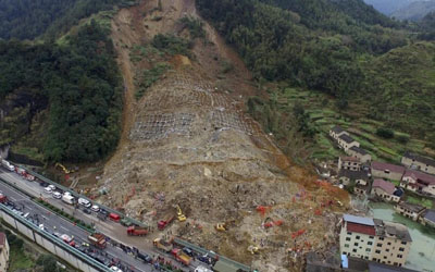
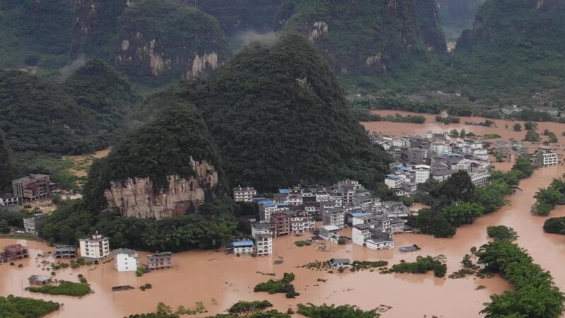
Most regions in China experience a rainy season. A large amount of rainwater seeps into the soil, which not only reduces the friction between the soil and the underlying rock but also makes the rain-saturated soil heavier—this rain can become the "last straw that breaks the camel's back." Large chunks of loose soil slide down the hillside like a "slide," burying houses and roads at the foot of the hill and even blocking rivers. Extremely heavy rainfall may also trigger mudslides, where the soil does not fall off in chunks but turns into a flood mixed with mud.
Once a landslide occurs, it not only causes casualties and property losses in the landslide area but also endangers houses, transportation, and human safety within a certain range. Given the problems of landslides—such as difficulty in prevention, rescue, and control, as well as severe hazards—how to timely and effectively monitor the state of mountains, detect abnormal conditions in advance, and issue timely alarms has become a key concern.
Due to the numerous hazards of landslides, understanding the laws of landslide occurrence and development and making accurate predictions for them are of both theoretical and practical significance. Collecting data during landslides is difficult due to factors such as the unpredictability of landslide timing and the short, rapid nature of the landslide process. If the data collected during landslides on different slopes can be scientifically analyzed, it will provide a scientific basis for accurate predictions in the future. At the same time, departments such as agriculture, water conservancy, urban and rural construction, transportation, forestry, and mineral resources also urgently need such results as a basis for planning and management.
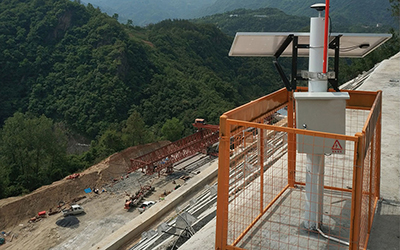
The online monitoring system for landslides and ground fissures mainly collects and processes information such as surface displacement monitoring, surface fissure monitoring, deep displacement monitoring, and groundwater level monitoring of various mountain bodies. It fully realizes the sharing of resources and information, enables safety analysis and evaluation of landslides, issues emergency warnings for dangerous situations, and can propose safety plans based on the current safety status and dynamic data changes, providing strong protection for safeguarding people's safety.
The online monitoring system for landslides and ground fissures consists of the following parts: a monitoring system, network transmission, a data processing platform, and a monitoring and alarm system.
The monitoring system is composed of various front-end sensors and data acquisition units (telemetry terminals).
The data collected by the data acquisition units (telemetry terminals) is transmitted to the designated information center via network transmission (2G/3G/4G/Beidou, etc.).
The information center integrates and analyzes this data through information technology to generate reports and charts, allowing on-duty personnel to intuitively monitor on-site conditions.
When abnormal data occurs, the alarm system can issue an early warning immediately.

Based on the principles of scientific advancement and the actual requirements of the owner, the system monitors the following items in real time for landslides and fissures:
Surface displacement monitoring
Surface fissure monitoring
Deep displacement monitoring
Groundwater level monitoring
Soil moisture content monitoring
Meteorological monitoring
Image acquisition
Early warning broadcast
The system supports the access of sensors for analog quantity, digital quantity, RS485, RS232, and event quantity.
The system supports three data communication methods: self-reporting, self-reporting-confirmation, and response. These three communication methods can form a hybrid network.
The system supports wireless communication modes such as 2G/3G/4G, Zigbee, LoRa, and satellite communication; it also supports wired communication such as RS485, RS232, and optical fiber, as well as a hybrid network communication mode combining wireless and wired.
The system supports the linkage function between data and video.
It supports SMS, email, voice, and acousto-optic alarms.
The system supports a multi-level networking solution, and realizes data sharing through real-time database synchronization technology.
Measurement data is accurate and uploaded in a timely manner; the operating status data is safe and reliable.
It works 24/7; the transmission system is independent and complete; maintenance and operation are convenient.
Advanced communication technology, mature and stable intelligent terminals, and unique data processing and control technology are adopted, making the system highly expandable in functions.
For monitoring points without on-site power supply, batteries or solar panel battery systems can be used to power the RTU (Remote Terminal Unit) system, with the most advanced low-power consumption technology adopted.