Deformation monitoring and dynamic characteristic analysis of bridge structures are important basic requirements for the safe operation of bridges. In recent years, with the development of GNSS technology—especially the continuous improvement and advancement of China's Beidou Navigation Satellite System—the Global Navigation Satellite System (GNSS) has been increasingly widely used in bridge structure health monitoring.
Modern large-scale bridges have relatively large spans. Meanwhile, when affected by typhoons and other factors, they exhibit significant vibration and swing amplitudes. In severe cases, this affects the normal operation of the bridge and even threatens the safety of the bridge, personnel, and vehicles.
Chenmai's independently developed deformation monitoring data processing software system has a rich library of GNSS error models. It supports high-precision long-baseline solution, multi-system joint solution, and automatic optimal search solution for various GNSS frequency combinations. The system can display in real time the real-time changes of key points and the entire bridge under various working environments and structural loads, obtain the bridge's health status, structural safety status, and operation status, and is used to evaluate the safety, durability, and serviceability of the bridge structure.
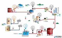
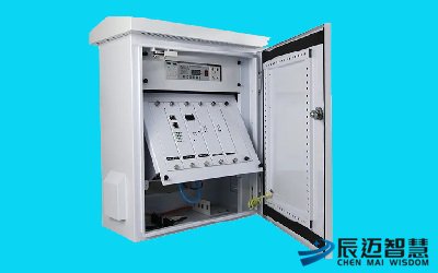
The Bridge GNSS Monitoring System consists of front-end data collection equipment, power supply equipment, transmission equipment, a monitoring center, and a mobile APP. The front-end data collection host transmits collected data—including video images, inclinometer data, displacement meter data, and position comparison data—to the monitoring center via wireless methods such as 2G/3G/4G/5G/NB-IoT.
The monitoring center software can display and analyze the data collected by the front-end equipment, while the mobile APP allows real-time viewing of the current monitoring status. When an alert occurs, the system sends early warning information to remind relevant command personnel to prepare for emergency rescue and disaster relief work.

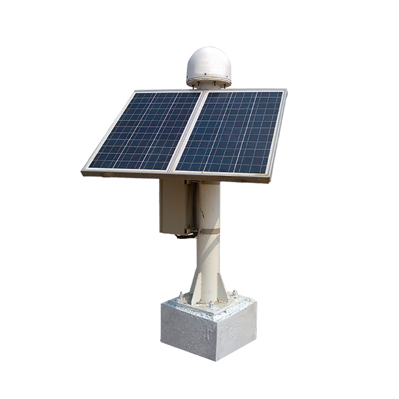
The data collection part is composed of surface settlement monitors, deep settlement monitors, external displacement monitors, stress-strain sensors, and image capture cameras. Its main function is to collect real-time on-site information such as position, displacement, and images.
The main equipment of the network transmission part is an intelligent telemetry terminal. It is responsible for connecting to front-end collection equipment and transmitting the collected data from the front-end equipment via 5G/4G/3G wireless networks, NB-IoT, WiFi, or other networks.
The data management center can be further divided into three sub-parts: the water resource monitoring cloud platform, the data processing center, and the database storage.
For the water resource monitoring cloud platform, either the dedicated water resource monitoring cloud platform provided (by the system) or a user-developed water resource monitoring cloud platform can be used. It displays and processes graphically converted data via large screens, PC terminals, and mobile terminals. At the same time, it stores the data in the database for permanent data storage.
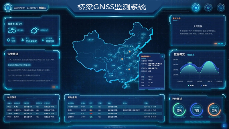
Monitoring Point Management: Enables the display, query, and statistics of bridge point information and monitoring network information.
Real-Time Collection of Monitoring Information: Conducts real-time online monitoring of bridge surface settlement, deep settlement, external displacement, stress and strain, etc., to grasp the structural changes of the slope in real time.
Real-time Monitoring of Monitoring Instrument Status: Through the spatial positioning function of GIS, the system can accurately locate the specific positions of various monitoring devices and intuitively display the working status of each device, i.e., whether it is operating normally.
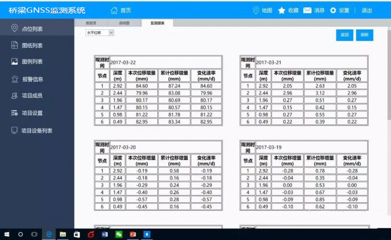
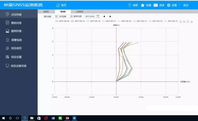
Monitoring Information Management and Analysis: It can retrieve the monitoring values of monitoring stations by time and type, generate corresponding graphs and line charts, and compare them with historical data of the same period.
Automatic Early Warning for Monitoring Points: The monitoring early warning thresholds for different monitoring points can be customized. When the monitoring value of the monitoring equipment reaches the early warning threshold, early warning information will be automatically sent to designated personnel. This allows for timely measures such as personnel intervention and bridge closure to eliminate potential safety hazards in their infancy.
★ Integrated Service: It provides an integrated software and hardware solution, offering one-stop and considerate services ranging from monitoring, transmission, data service to business application. For the system software, the intelligent monitoring and early warning cloud platform mode provided by Chenmai Wisdom can be selected.
★ Integrated Monitoring Station: The integrated structural monitoring station features high reliability, small size, no need for integration, easy installation and low cost. It is dust-proof, waterproof and lightning-proof, and can adapt to harsh working environments such as outdoor rain and humidity.
★ Multiple Networking Methods: The system supports multiple communication and transmission methods including 2G/3G/4G/5G mobile communication, SMS alarm and Beidou satellite.
The platform enables convenient device access, allowing real-time viewing of device monitoring data and operating status, and easy realization of remote device monitoring and management. It provides a series of standardized data services covering the entire process from data collection, transmission, processing, compilation, storage, analysis, and presentation to data push. It supports rapid deployment and launch, with elastic scalability, and enables both universal and customized business applications.
The Bridge GNSS Monitoring System can be used for real-time online monitoring of various required measurement values of bridges. Data is transmitted to a local server for permanent local storage, supporting real-time monitoring of data and on-demand access to historical data.
Data is also uploaded to the cloud for permanent backup. Through the learning algorithms and models embedded in the cloud, the system analyzes various bridge monitoring data, comprehensively evaluates the health status of the bridge, and effectively provides early warnings, prevents, and curbs the occurrence of major accidents. This buys time for users to organize emergency rescue and evacuate people in affected areas, reducing casualties and property losses caused by accidents.