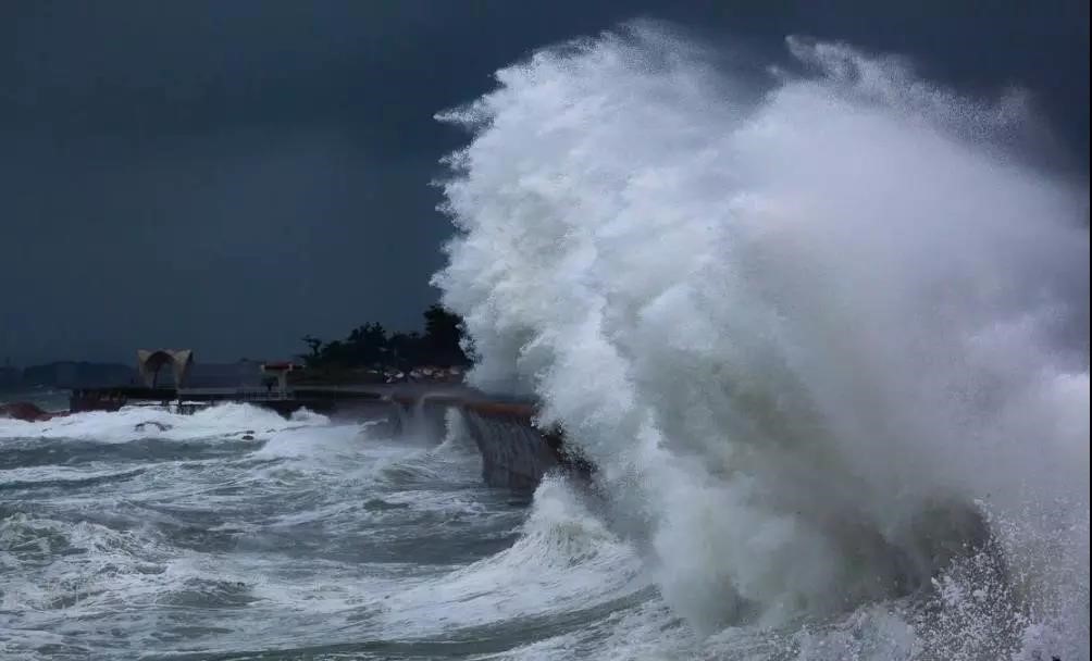
In recent years, China's marine economy has maintained steady growth, bringing new opportunities for the country's comprehensive national strength. However, the annual losses caused by marine disasters cannot be ignored. These disasters include storm surges, ocean waves, sea ice, tsunami dynamic environment disasters, red tides, green tides, and more.
In response to current situations and issues such as weak marine supervision, severe marine environmental pollution, frequent disasters, prominent aquatic product quality and safety problems, low-level management and industrialization of marine ranching, and insufficient real-time marine monitoring information, the Smart Marine Disaster Monitoring and Early Warning System is adopted to obtain various types of marine information in real time. This system can maximize the connection and utilization of marine information resources in economic and social development, improve the level of marine informatization capabilities, and meet the needs of the rapid development of the marine economy.
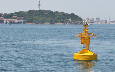
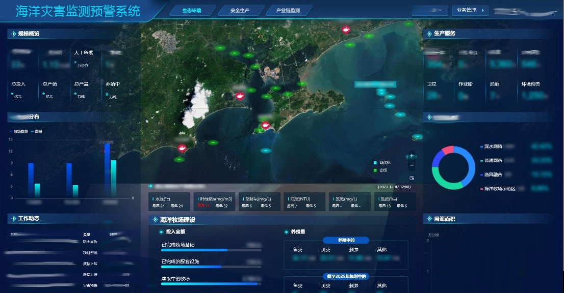
The Smart Marine Disaster Monitoring and Early Warning System mainly obtains regional data and information of the observation sea area through various observation and monitoring sensors, various base stations and networking technologies distributed in the sky, air, shore, sea, and seabed, supplemented by means such as voluntary ships and scientific research ships. It realizes marine hydrometeorological monitoring, marine ecological environment monitoring, dynamic sea area monitoring, marine environment monitoring, etc., and transmits the data to the data application demonstration system through network communication for real-time information display.
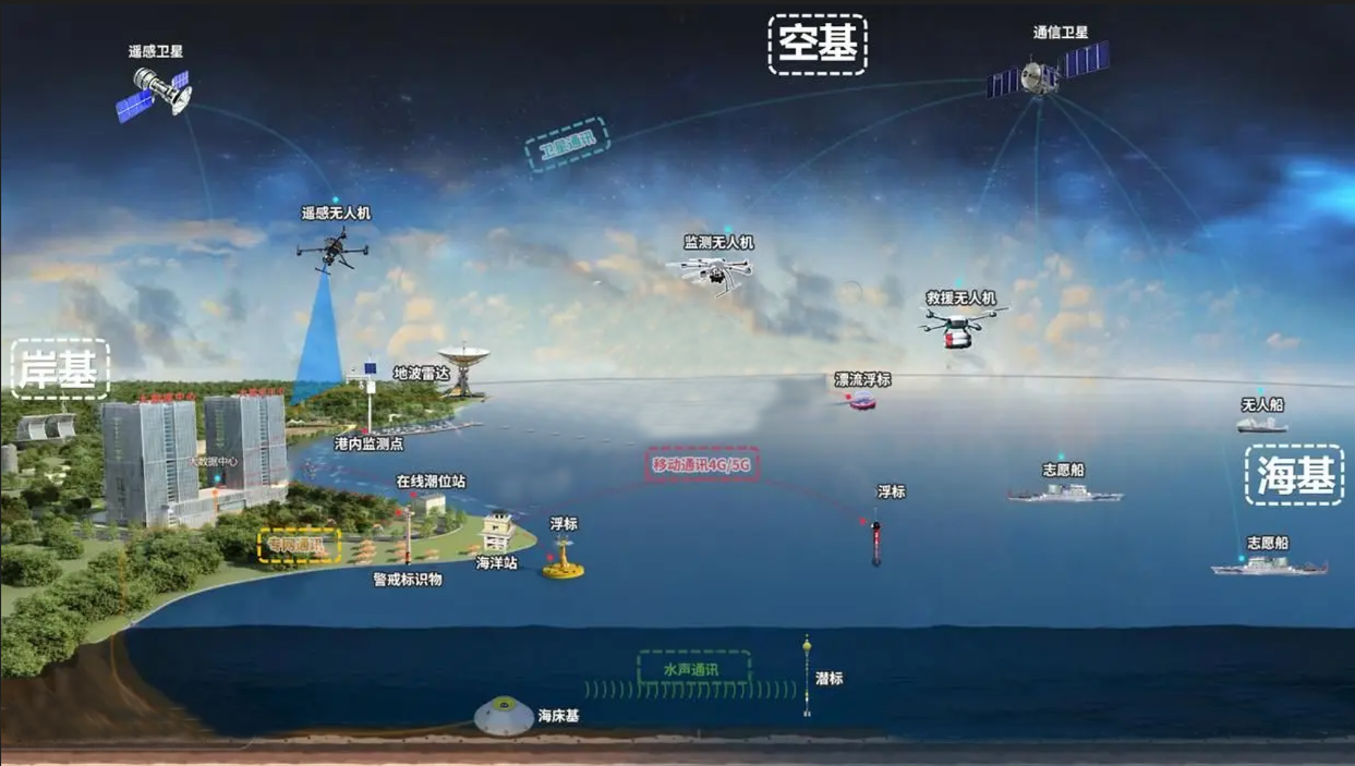
It integrates multiple functions, including marine use activity management and control, marine hydrometeorological support, disaster prevention and mitigation, marine ecological environment monitoring and protection, scientific research and technical equipment testing, and marine equipment industry demonstration.
Meanwhile, it can realize early warning and forecasting of marine disasters such as red tide outbreaks, oil spill drift, cold water mass intrusion, typhoons, and storm surges; monitor offshore operation ships, as well as the discharge and drift of pollutants; and monitor the water quality of aquaculture areas, cage conditions, and fish growth status.
Additionally, it can provide information support for marine-related enterprises and public institutions such as fishery law enforcement and management departments, maritime management departments, scientific research institutions, and offshore construction units. It also supplies fast and reliable observation data for various application systems in the monitored sea area, including early warning and forecasting systems, information service systems, auxiliary decision-making systems, and comprehensive support systems.
It enables map display and viewing of online monitoring, including quick query and display of monitoring equipment, display of monitoring data, display of alarm status, and real-time display of monitoring data curves. Through the display function on the main interface of the system, users can view the location and operating status of the equipment, and grasp the real-time monitoring of data collection and monitoring equipment for marine stations, shore-based observation stations, buoys, unmanned ships, water quality, sea surface height, waves, tides, ocean currents, seawater temperature, pH value, and other parameters.
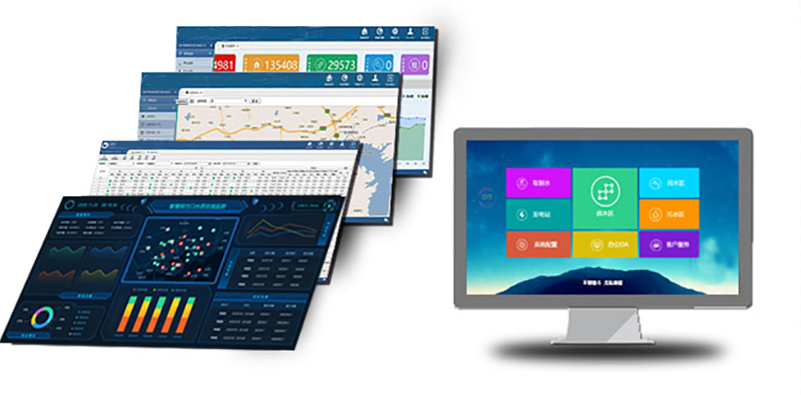
Through various types of sensors deployed at marine stations, observation stations, buoys, wave-tide gauges, and those for monitoring seawater temperature, air temperature, wind, and precipitation—key factors causing abnormal coastal sea levels—data related to various marine disaster risks is collected. This data is transmitted to relevant software systems to achieve full-range, real-time monitoring of the entire ocean. When data exceeds the alarm threshold, the system automatically issues alarm information of different levels based on the early warning data. It supports multi-level alarm settings and can deliver alarms to relevant leaders and responsible persons through multiple methods, including pop-up software window alarms, email alarms, SMS alarms, and sound-light alarms.
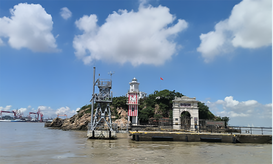
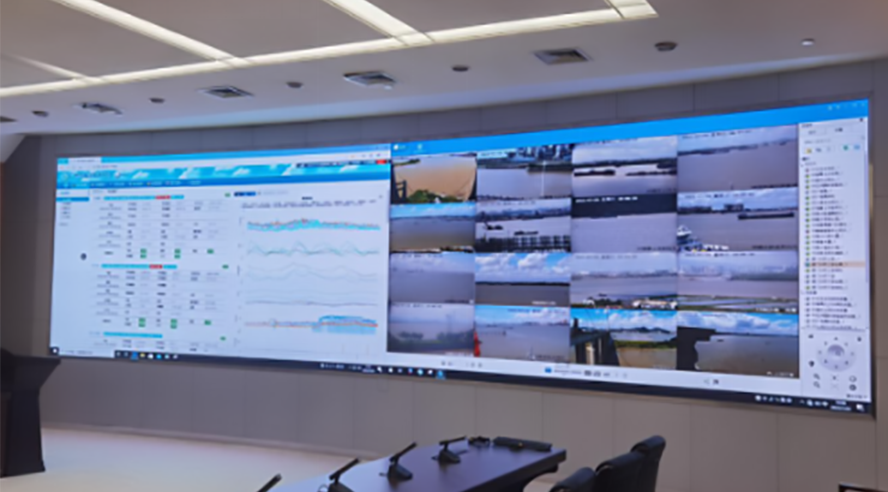
It includes real-time video monitoring of marine stations, shore-based observation stations, and coastal areas to enhance the early warning capability for storm surges, ocean waves, sea ice, and other hazards in high-risk regions. Users can view real-time on-site video images from monitoring terminals. Meanwhile, they can control on-site camera lenses and pan-tilt heads through software to adjust aperture size, focal length, zoom level, and video angle as needed. This meets users' needs for multi-angle video monitoring of the on-site situation and ensures the safe operation of the marine disaster monitoring and early warning system.
It conducts comprehensive comparative analysis on relevant data, mainly including historical data from various observation and monitoring sensors distributed in the sky, air, shore, sea, and seabed. It calculates the temporal and spatial correlation of marine operation data and comprehensively judges the health status related to marine disasters.
Under applicable premises, new ideas and methods in the management process of the Smart Marine Disaster Monitoring and Early Warning System are integrated into system development. This achieves the integration of data and graphics, and the combination of GIS and mathematical models, presenting the results of scientific calculations in an intuitive way through 3D scenarios and dynamic forms.
In China, marine disasters are characterized by a wide variety, broad geographical distribution, and high frequency of occurrence, causing severe economic losses to the country and its people every year.
Sea level rise is a key indicator of climate change. Against the backdrop of global warming, accelerated sea level rise has exerted extensive impacts on the coastal natural ecological environment and the development of human economy and society.
By understanding the occurrence of marine disasters and the status of sea level rise, and through continuous monitoring, we can better grasp the formation mechanism, development process, and impact scope of disasters, thereby providing a scientific basis for early warning.
Establishing a comprehensive marine disaster early warning system is of great significance for improving the response capacity to marine disasters and reducing the losses caused by them.